The 2 December 2020 Beach Road Landslide in Haines, Alaska
The 2 December 2020 Beach Road Landslide in Haines, Alaska
On 2 December 2020 at 1:17 pm local time a large landslide occurred close to Haines in Alaska. Now known as the Beach Road Landslide, the failure sadly killed two local residents. A team has now undertaken an initial analysis of the landslide, published as an open access paper in the journal Landslides (Darrow et al. 2022).
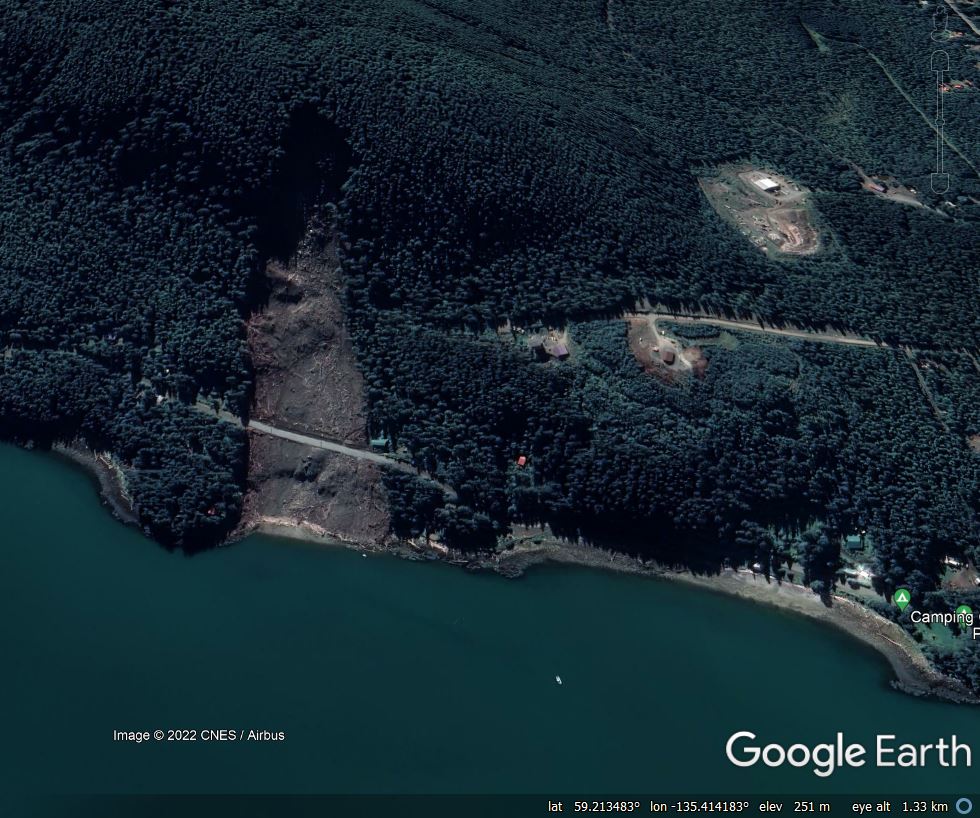
The landslide itself is clearly visible on Google Earth, located at 59.219, -135.412:-

.
The landslide is about 690 m long, 170 m wide, with a volume of about 107,000 cubic metres and an average slope angle of 20 degrees. The landslide was triggered by an “atmospheric river” that generated rain-on-snow, which is dangerous combination for landslide initiation. The failure started as a debris avalanche that transitioned into a debris flow.
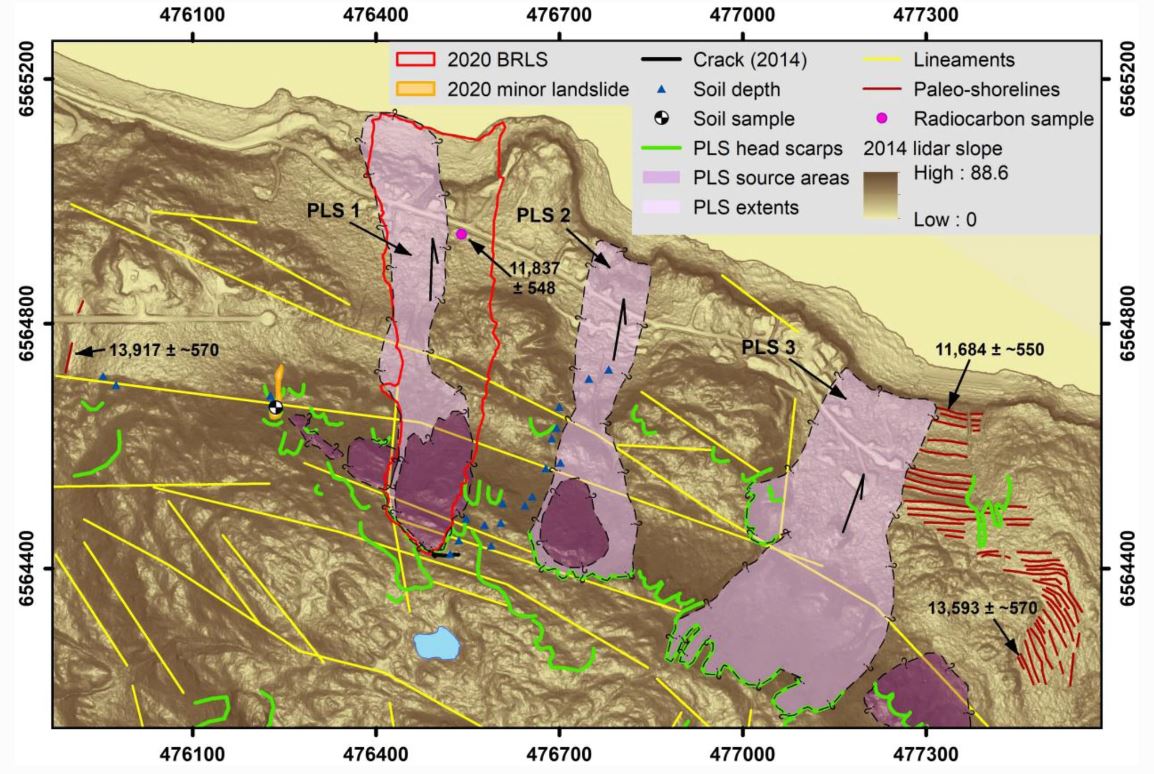
Perhaps the most interesting aspect of this paper is the landslide history of the ridge from which the failure initiated. Lidar data was used to map the geomorphology of the site – the team found three large palaeo-landslides, plus a large number of head scarps of previous failures:-

.
The landslide initiated in a heavily fragmented, displaced area of rock that was evident in Lidar data collected before the landslide, as the diagram above shows (the boundary of the 2020 landslide is outlined in red). Darrow et al. (2022) describe the sequence:
The rock itself is weak and easily disintegrates. Once in motion, the moving rock mass quickly pulverized and incorporated additional water, becoming a debris flow.
Prior to the atmospheric river, snow had accumulated on the site. As the storm passed through the temperature rose above freezing, and on 2 December 168 mm of rainfall fell, breaking the all-time daily precipitation record for the local rain gauge. Over a two day period (1 to 2 December 2022), the precipitation recorded (261 mm) represents a 500 year return period event. Water accumulated in a pond above the head scarp, flowing into fractures in the source area of the landslide.
The final point of note for me from the paper is the key implications of climate change for landslides in this area. Climate models indicate that this area will see higher winter temperatures and increased precipitation. Thus, the slopes will be exposed to more rainfall and more rain-on-snow events. The implications in terms of the likelihood of landslide activity are clear.
.
Reference
Darrow, M.M., Nelson, V.A., Grilliot, M. et al. 2020. Geomorphology and initiation mechanisms of the 2020 Haines, Alaska landslide. Landslides. https://doi.org/10.1007/s10346-022-01899-3


